There is an interesting* post at Highly Allochthonous looking at the likely reasons and type of the earthquake (hattip: NickS).
It appears to be quite a shallow rupture, on the Canterbury Plains close to Christchurch, and the focal mechanism indicates largely strike-slip motion.
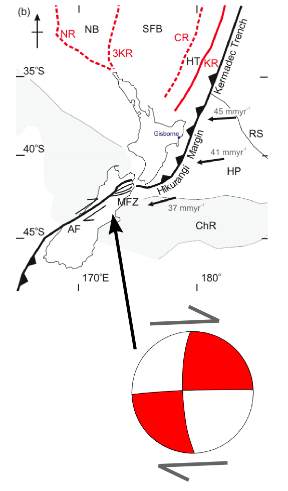
New Zealand is one of the oddest places geologically (Japan is similar) in the world because of our position between two plates and because we are at the twist where the plates change how they interact with each other.
The subduction zone around Marlborough has been rapidly (in geological terms) been moving southwards for some time. This causes faulting all the way down towards Christchurch as the block structures adjust to ongoing pressure.
The remainder of the HA post is relatively readable
This tectonic evolution is ongoing, and since the end of the subduction zone is now actually to the south of the southernmost and youngest of the Marlborough faults. Some of the plate boundary deformation is probably therefore being shunted into the region around Christchurch, where it needs to be accommodated by dextral strike-slip faulting. Eventually, over geological time, this deformation will lead to the formation of a new, more southerly strand of the Marlborough Fault system. It also means that earthquakes of this type of size are unlikely to be a one-off event in this area. Unsurprisingly, then, seismic surveys have identified a number of active faults beneath the recent sedimentary cover on the Canterbury plains (although they were identified in the linked study as reverse faults accommodating compression, strike-slip deformation is very difficult to identify if you only have a 2 dimensional cross section to work with).
Whilst this map of large historic earthquakes in New Zealand shows that earthquakes of this magnitude can occur pretty much anywhere in New Zealand, seismicity in this particular area has some particular hazards; it is close to a heavily populated region (Christchurch) built mainly on unconsolidated Quaternary sediments, which will intensify the potential shaking and damage to unreinforced buildings. Fortunately, whilst this earthquake appears to have caused a fair amount of damage, from the early reports casualties seem to be light.
That last paragraph indicates why the action of the earthquake seems to more violent at ground level than the amount of energy expended. Local seismographs would over report the energy because of this effect. Those further away would get a better picture of what happened. This is probably why the magnitude dropped from the initially reported 7.4 to 7.1
* at least to me
Powered by WPtouch Mobile Suite for WordPress